R 49 500 000
 | Farm for Sale in Ladismith Rural


Farm For Sale in Klein Karoo
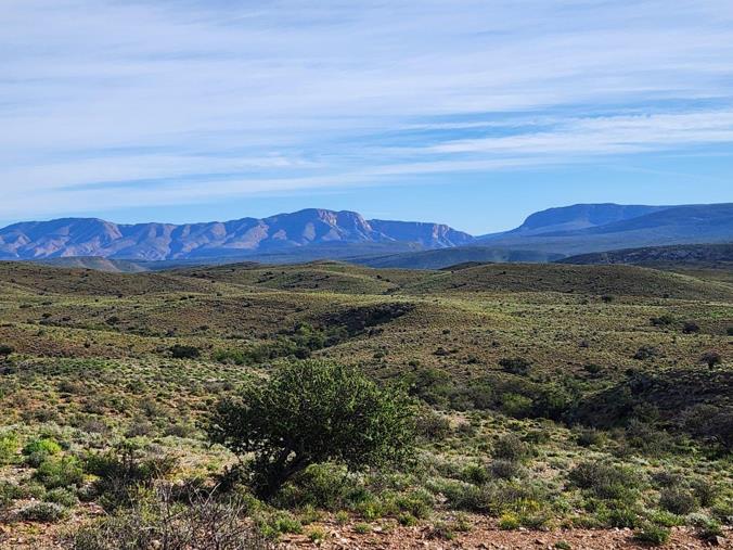
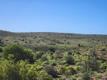
This 5 459-hectare property in the Western Klein Karoo presents a rare opportunity to acquire a large-scale conservation landscape within one of South Africa’s most distinctive semi-arid regions, suited to long-term stewardship and conservation-focused ownership.
Bordering a well-established private reserve, the property forms part of a broader ecological corridor and should be regarded as a conservation-scale holding rather than a conventional production farm. Opportunities of this scale, continuity and ecological integrity are increasingly limited.
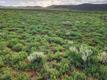
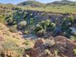
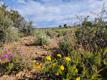
Ecological Recovery
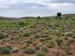
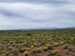
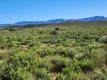
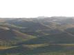
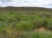
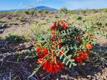
Sheep farming on the property ceased in 2004. Since then, the landscape has been allowed to recover naturally, resulting in measurable improvements in veld condition, plant diversity and perennial ground cover. Independent long-term vegetation monitoring undertaken on the property indicates a stable and improving ecological trajectory, supported by measurable increases in plant diversity and perennial ground cover. Seasonal responses to rainfall reflect a well-established natural regeneration cycle, indicative of a resilient and functioning veld system.
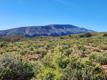
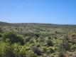
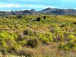
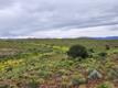
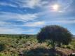
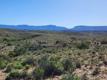
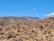
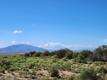
Landscape Character
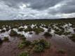
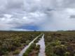
The terrain includes open plains, valleys and rugged foothills typical of the Western Klein Karoo. Its scale allows for landscape-level conservation rather than fragmented land use.
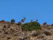
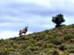
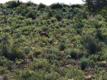
Indigenous wildlife, including kudu, gemsbok, springbok, duiker and steenbok, move naturally across the property as part of a broader, functioning ecological system.
Geological Context
The property lies within the fossil-bearing Klipbokkop Formation and contains documented Devonian marine and early terrestrial fossil material, reflecting a transitional Gondwanan ecosystem approximately 390 million years ago. This adds a layer of scientific significance to the landscape.
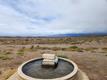
Water
The property is supported by a natural spring and several boreholes, together with an established water distribution network extending across the property. Water availability reflects the character of a semi-arid Klein Karoo environment and is suitable for conservation use and moderate development.
Infrastructure
Infrastructure remains intentionally minimal. Apart from one historic 1800s stockman’s cottage, there are no additional dwellings or buildings. Internal farm roads and fencing provide practical access while the landscape remains largely undisturbed.
This limited development footprint allows a future owner flexibility in determining a long-term conservation or low-impact development vision.
Access and Privacy
A registered subdivisional public road traverses a portion of the property. However, the overall scale of the landholding provides extensive areas of seclusion within the interior of the property.
Strategic Positioning
The property lends itself to several long-term applications, including:
• Private conservation reserve
• Long-term legacy ownership
• Environmental research or restoration initiatives
• Low-impact conservation tourism
Offering
Due to the scale and ecological sensitivity of the property, further information, mapping and supporting documentation will be shared with appropriately qualified and aligned parties.
Property Overview
Farm Details
Contact AgentWeb Ref 116691745
 Send Agent a Message
 Agency

Agents


Latest Listings
-
3 Bedroom House for Sale in Helderrand, Somerset WestR 5 250 000 -
4 Bedroom House for Sale in La Concorde, Somerset WestR 8 950 000 -
3 Bedroom House for Sale in Penhill, EersterivierR 2 675 000 -
2 Bedroom Apartment / Flat for Sale in De Velde, Somerset WestR 2 300 000 -
5 Bedroom House for Sale in La Concorde, Somerset WestR 15 200 000